What is geoSherpa?
How does geoSherpa work?
geoSherpa consists of the following three components making the creation and deployment of geoSherpa Guides simple, intuitive, and without the need to delve into code. As additional Web GIS viewers are developed, we will build components to integrate with those. We will be adding support for the ArcGIS Experience Builder and Geocortex Web Viewer, when the SDKs become available.
geoSherpa Planner
geoSherpa Planner is a Windows Desktop application providing a simple WYSIWIG development environment to create and manage your Guides.
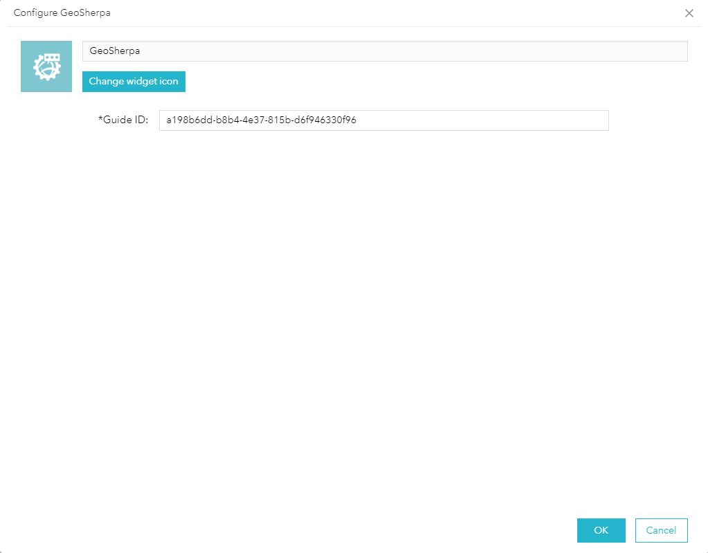
geoSherpa Widget
geoSherpa’s Web AppBuilder Widget allows your to easily integrate geoSherpa Guides. Drop the geoSherpa Widget into your Web AppBuilder for ArcGIS (Developer Edition). It is as simple as cut and paste.
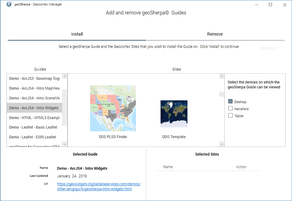
geoSherpa Deployment Tool
geoSherpa’s Deployment Tool for Geocortex provides a simple interface to install or remove geoSherpa Guides quickly and efficiently.
geoSherpa Terminology and Definitions
geoSherpa is built on the concept of travel tour guides. Our terminology reflects that concept.
- Guide(s) – geoSherpa Guides are designed and managed using the geoSherpa Planner. For each Web GIS application, you will develop a specific Guide. Each Guide may contain the following Guide Items:
- Tours – Tours are interactive tutorials built using the geoSherpa Planner that guide your users through specific tasks within your Web GIS application.
- Videos – Videos are links to Youtube and Vimeo videos that are displayed in the geoSherpa Panel.
- FAQs – Frequently asked questions (FAQs) are textual instructions/answers. These can be configured as plain text, HTML, and as Markdown.
- Module – When we refer to the geoSherpa Module, we are described the JavaScript code that runs geoSherpa Panel within your specific Web GIS application.
- Panel – The geoSherpa Panel is the popup dialog your end-users see within your Web GIS application that loads the Guide and it’s associated Tours, Videos, and FAQs.
- Planner – The geoSherpa Planner is a Windows Desktop application where you create and manager your geoSherpa Guides and their associated Guide Items.
- Widget – The geoSherpa Widget refers to the Web AppBuilder for ArcGIS Widget that loads geoSherpa Guides into your Web AppBuilder sites.